Wild Connections Conservation Plan
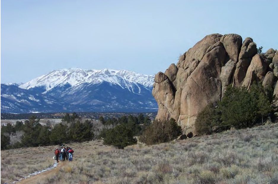
The Wild Connections Conservation Plan (WCCP) was created by people who share a deep concern for the well-being of public lands spread across the Arkansas and South Platte headwaters basins. From hunters and hikers to biologists and volunteer mappers, they worked together to map the boundaries of 100 roadless areas, explore some of central Colorado’s wildest lands, and apply the science of conservation biology. Over a decade, they developed and refined a landscape wide vision of a network of protected core areas and wildlife linkages. The Wild Connections Conservation Plan describes how this vision can be a reality where it counts – in the everyday policies and management of the Pike-San Isabel National Forests, BLM and state lands.
The WCCP, published in 2006, will be reviewed prior to the next revision of the PSI Forest Plan which is unlikely to occur until 2022 or later. While the original data is accurate to the best of our knowledge, conditions on the ground have changed. Please contact us if you have new information.
WCCP complex map Jean Smith, Wild Connections
Interior Department Completes Removal of “Sq___” from Federal Use
WASHINGTON — The Department of the Interior today [9/8/2022] announced the Board on Geographic Names (BGN) has voted on the final replacement names for nearly 650 geographic features featuring the word sq___. The final vote completes the last step in the historic efforts to remove a term from federal use that has historically been used as an offensive ethnic, racial and sexist slur, particularly for Indigenous women. “I feel a deep obligation to use my platform to ensure that our public lands and waters are accessible and welcoming. That starts with removing racist and derogatory names that have graced federal locations for far too long,” said Secretary Deb Haaland... Together, we are showing why representation matters and charting a path for an inclusive America.” The list of new names can be found on the U.S. Geological Survey website with a map of locations.
New names were given to four locations in the WC region:
- Tabeguache Creek, a stream in Chaffee County at 38.583115 -106.081753
- Soapy Creek, a stream in Fremont County at 38.6063839 -105.5308298
- Evening Star Mountain, a summit in Teller County at 38.71480589 -105.1465493
- Maize Gulch, a valley inTeller County at 38.7309915 -105.1605981
- The WCCP is organized around major geographic features into 11 complexes: Arkansas Canyons, Mosquito Range, Mt. Evans (Mount Blue Sky*) High Peaks, Pikes Peak Massif, Rampart Range, Sangre de Cristo, Sawatch Range, South Paak, South Platte Canyons, Spanish Peaks and Wet Mountains. They encompass the Pike-San Isabel National Forest (PSI), but are spread across the entire geography which includes BLM, National Park Service, State, County and privately owned lands. Management recommendations are intended only for the PSI and BLM lands. WCCP outline
- Introduction and description of the Pike-San Isabel National Forests and Comanche National Grasslands and general threats to public lands.
- Wild Connections methodology includes the components of the core reserve system and the three-track approach to network design.
- Forest-wide management recommendations for broad categories such as grazing, fire management, invasive species, etc.
- Thematic planning framework for management emphases on specific parcels of land across the forest, for example Wilderness, quiet use areas, motorized recreation, etc.
- Geographic complexes descriptions with ecology, natural values and a summary of management.
*Mount Blue Sky in line for name change
Mt. Evans is on track to be renamed Mt. Blue Sky to honor Colorado's indigenous peoples. The Arapaho were known as the Blue Sky People, and the Cheyenne hold an annual renewal of life ceremony called Blue Sky.
The name change has been approved by the Colorado Geographic Naming Advisory Board and Gov. Polis, and is awaiting final approval by the U.S. Board on Geographic Names. The next US Board meeting is in April 2023
Background
Renaming a geographic feature is a long process. A proposal is circulated to local governments, interest groups and in this case tribal representatives. When there is sufficient endorsement the petion is sent to the Colorado Geographic Naming Advisory Board (CGNAB) that holds four public meetings. The Board's recommendation is sent to the Governor for his/her approval, and then forwarded to the U.S. Board of Geographic Names for final approval. This could take months or even years!
Wild Connections sent a letter of support for Mt. Blue Sky to the Colorado Geographic Naming Advisory Board, copied to Gov. Jared Polis and the U.S. Board of Geographic Names.
John Evans, Colorado’s second territorial governor, resigned after the 1864 U.S. cavalry massacre of more than 200 Arapaho and Cheyenne people, most of them women, children and the elderly, at Sand Creek in what is now southeastern Colorado. Today Sand Creek Massacre National Historic Site is a place of commemoration and healing.