Climate Hikes
Browns Canyon National Monument
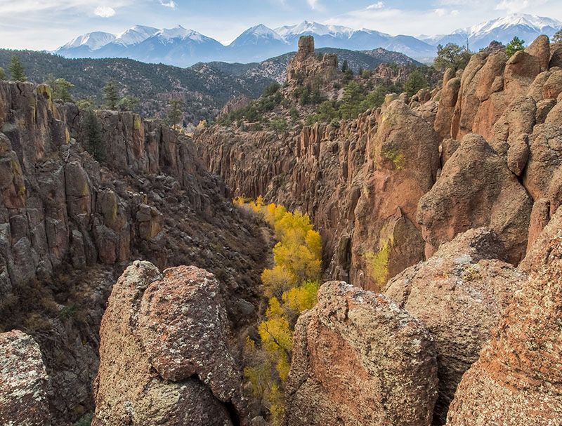
Photo Friends of Browns Canyon
Wild Connections and Friends of Browns Canyon (FBOC) host climate resiliency educational hikes to the 21,589-acre Browns Canyon National Monument (BCNM).
Railroad and Stafford Gulches

Hiker on the edge of Railroad Gulch. Photo Wendell Day
In 2023, we visited Stafford Gulch, the southern boundary of BCNM, and the Railroad Gulch area to the south. These areas were identified by Rocky Mountain Wild as being one of the “Best” areas for Climate Refugia. They have "cold air pools” and are expected to support biodiversity, a healthy natural variety of animal and plant species that will persist as the climate warms.
Middle Cottonwood Creek
.JPG)
Browns Canyon National Monument's Middle Cottonwood Creek. Photo John Sztukowski
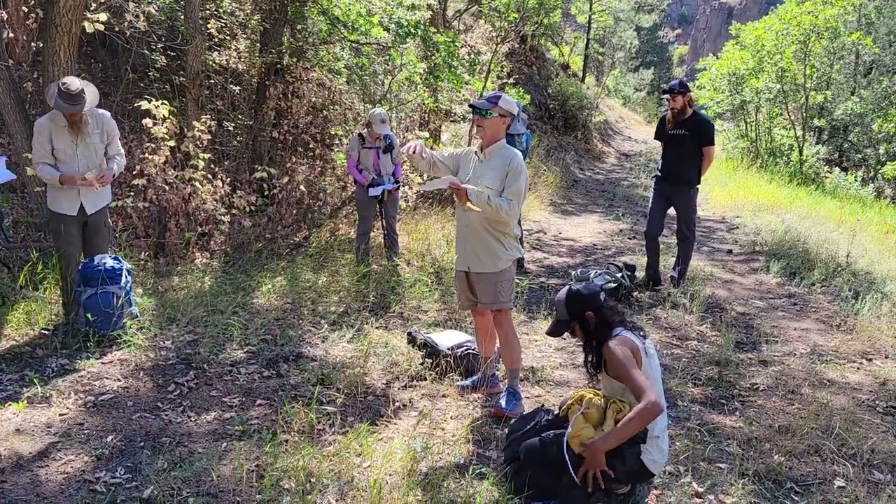
In November 2024 Wild Connections and Friends of Browns Canyon hiked down middle Cottonwood Creek in Browns Canyon National Monument, starting from Bassam Park. There were scenic views of the Monument as well as the Sawatch Range/Collegiate Peaks across the valley. Data loggers that have been recording temperature, humidity and other data for the past few weeks were retrieved. (Scroll on to see a report on the data logger results)
.jpg)
Hikers in Middle Cottonwood Creek. Photo Wild Connections

The big view. The hikers are in the red circle
if you have sharp eyes! Photo Dalton Reed

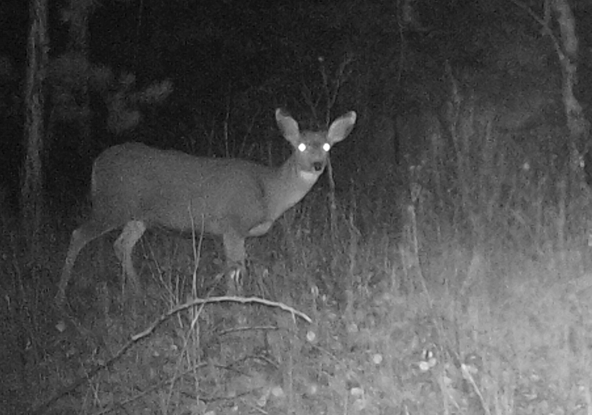
Many deer were caught by the game camera browsing both day and night.
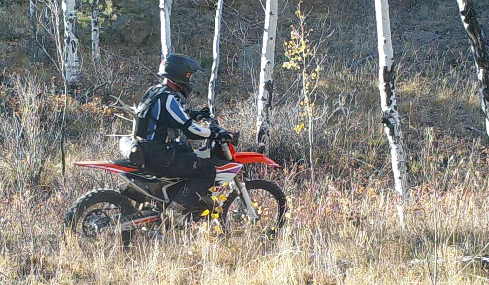
The game camera also captured this biker riding and deer shed collecting, both illegal in the National Monument
North Fork Trail, South Platte River
Karl Ford led a climate education hike on the North Fork Trail along the S Platte River. Data loggers that record high and low temperatures were recovered. Data loggers are one tool in the search for cold air pools that may foster long term biodiversity as the climate changes.
Climate Corridors and Refugia Modeling
Central Colorado Climate Resilience Project
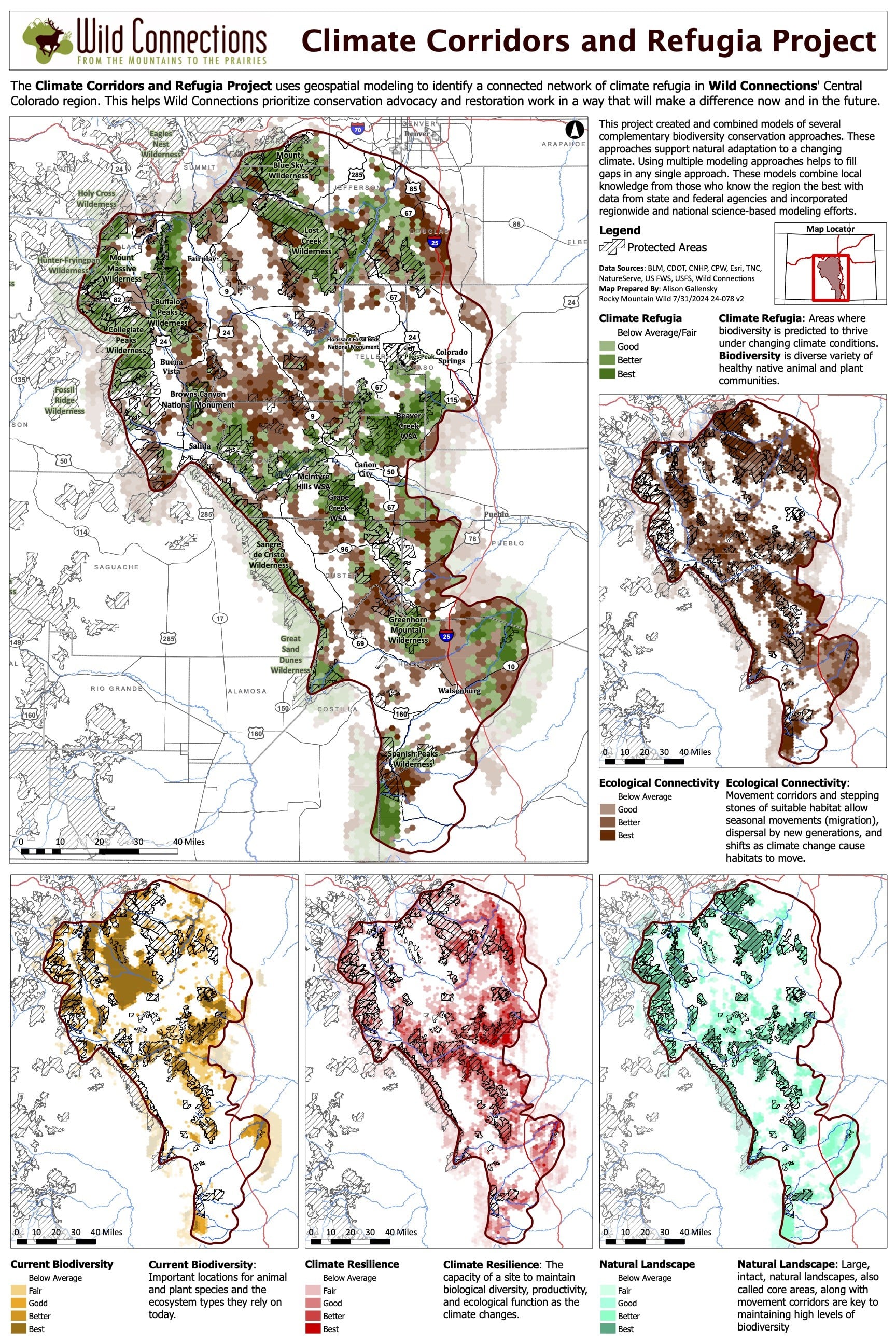
Updated 2024 Wild Connections Climate Corridors and Refugia Award Winning Map by Alison Gallensky
Wild Connections is identifying climate corridors and refugia in their region in Central Colorado. The goal of this project is to help Wild Connections prioritize their advocacy and restoration work in Central Colorado in a way that will make a difference now and in the future as the region is impacted by climate warming.
Wild Connections is working with Rocky Mountain Wild to perform a geospatial analysis that will identify this network of climate refugia and corridors that connect them. Climate refugia are areas where biodiversity, a healthy natural variety of animal and plant species, will persist as the climate changes. Corridors provide linkages between these areas that are crucial for seasonal movement and dispersal of animals and plants including shifts necessitated by climate warming.

View this video to explore more.
- The project approach is based on the important work by Oswald Schmitz and others titled Conserving Biodiversity: Practical Guidance about Climate Change Adaptation Approaches in Support of Land-use Planning. We modeled a number of different adaptation approaches across varying ecological levels: species and population level, ecosystem level, and landscape level. Using multiple modeling approaches can help to fill gaps in any single approach.
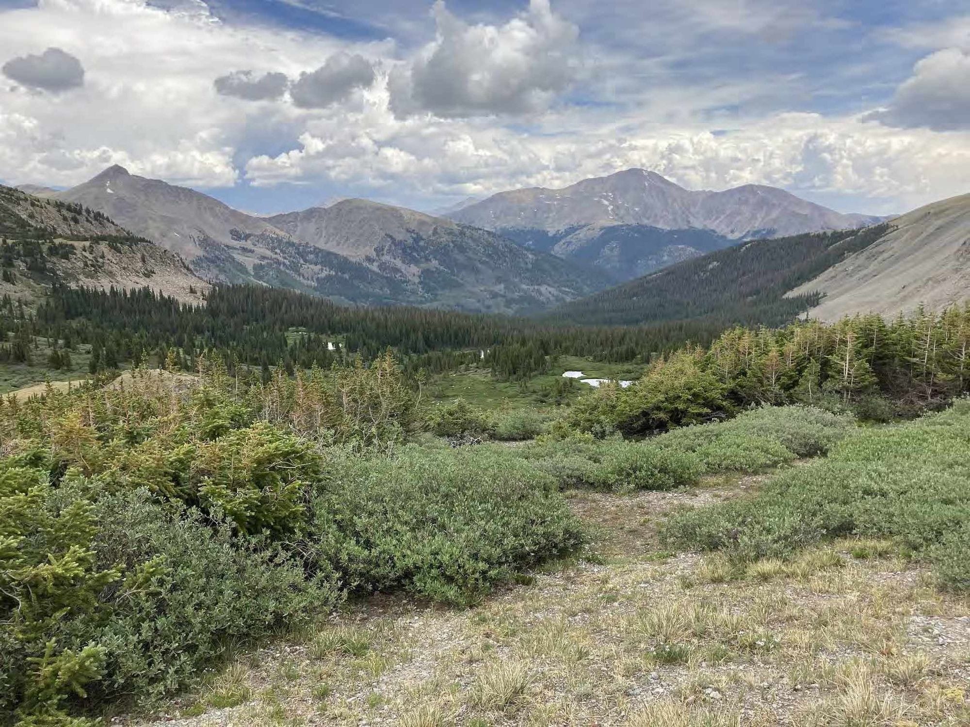
View from the Ptarmigan Lake area to the high mountains. Photo Alison Gallensky
This modeling effort combined local knowledge from those who know the region the best with data from state and federal agencies and incorporated regionwide and national science-based modeling efforts from The Nature Conservancy and NatureServe. Go here to download a summary of the modeling process.
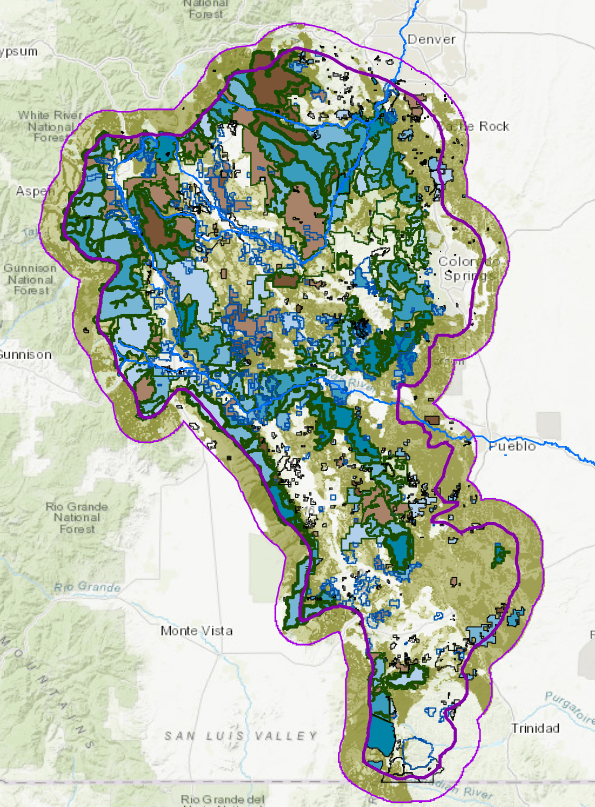
Climate modeling map. Alison Gallensky, Rocky Mountain Wild
The map above shows the complexity of the modeling. Click on it, or go to the interactive map here to turn layers on or off.
Middle Cottonwood Creek
November 2024 Datalogger Results